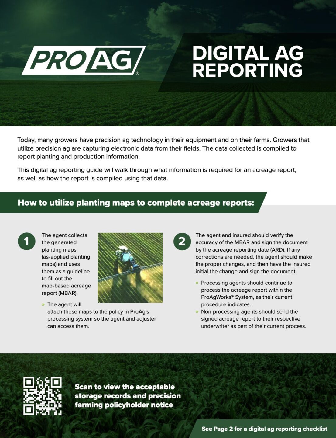
Digital Ag
Precision Ag Means Different Things
Precision Ag is a term used to indicate the use of modern technologies in a growing operation. Global-Positioning Systems (GPS) are utilized to steer implements and machines automatically, Mobile Implement Control Systems (MICS) have been developed to run and record information from machines and implements, and Geographic Information Systems (GIS) are leveraged to gather and manage agricultural data collected through equipment computers and other hardware. A Precision Ag operation will typically include the use of external remote aerial, space-based, or ground-based sensors and other informative data sources. Typically, a Farm Management Information System (FMIS) will be employed to house all of the information a Precision Ag grower is capable of producing.
Growers that use precision ag technology will do more than simply store this information. Using the systems described above, growers that utilize precision ag technology and data can leverage their operational data to produce site-specific agronomic decisions. This enables field prescriptions – be it seed, chemical, fertilizer, irrigation or otherwise – down to a site-specific point based on the varying levels of potential in a particular field. This technology and data allow for quick, in-field decisions and further yield optimization while preserving both natural and operational resources. There is also the added benefit of easing a grower’s federal reporting requirements through streamlined data collection and delivery systems.
Common Precision Ag Solutions
There are many options available to handle this data. Here is a summary of the main types of systems in the agricultural industry today:
Auto-Steer and GPS guidance uses GPS signals to automatically steer or guide a machine or implement. Various accuracies are available and can steer or locate machines and devices within a 1 inch to 2 foot repeatable position (Examples: RTK 1-2”, OmniStar 2-5”, WAAS 6-24”, GLONASS 6-24”).
Located in a cab, these GPS controlled systems control the machine/implement itself. These devices can also record and distribute data to other systems.
- Planter/Seed Monitors use GPS position to monitor location of seed population, overlaps, and skips while recording and controlling how, where, and when seed is planted.
- Yield Monitors use GPS position, sensors, and associated electronics mounted on a harvester to quantify the yield for the crop being harvested on an instantaneous and averaging basis. The Yield Monitor data can be combined with the Plant/Seed Monitor data for effective evaluation of farming practices by soil type, variable rate application, nutrient program, etc.
GIS (Geographic Information Systems) programs use GPS positions and Geo-referenced maps to capture/store data, analyze, and manage different layers of data. FMIS (Farm Management Information Systems) is a system which visually coordinates and manipulates data mainly from agricultural practices as well as provides general record keeping management. Uses data from MICS controllers and Remote sensed data to create and manage valuable datasets to prescribe decisions and work orders to a field with a MICS controller.
Remote Sensing
The act of detection and/or identification of an object, series of objects, or landscape without having the sensor in direct contact with the object. Common examples include Satellite imagery taken from space (100-500 miles above the earth) to determine vegetative growth and patterns in a field or Aerial imagery taken within airspace to determine vegetative growth and patterns in a field. (Examples: Planes, Unmanned Aerial Systems (UAS/Drones)
- Ground: Used to measure temperature, moisture, EC (electro conductivity), PH, organic matter, etc.
- Weather: Ground or satellite based equipment used to measure temperature, moisture, sun reflectiveness, wind speed, etc.
- Mobile: A hand held device or mounted to an implement which records infrared, temp, nitrogen, PH, and other signatures from a plant or soil.
How could digital or precision ag work in crop insurance for me?
Most Common Crop Insurance Solution
The main Precision Ag systems that could be used in Crop Insurance are Planting Monitors and Yield Monitoring Devices. These could be leveraged to fulfill MPCI planting and production reporting requirements. This method is currently supported by FMIS software which works with the devices that capture electronic data from the field and compiles it to accurately report planting and production information. These systems work together to eliminate errors and increase efficiency for both the agent and the grower.
Precision Ag Opportunities
Today many growers have precision ag technology in their equipment and on their farms. This offers a unique opportunity for approved insurance providers, agents and growers to collaborate using the captured electronic data.
Growers that use Precision Ag equipment are finding they need help handling all of the data. They need a “trusted advisor” to help them decide how to use their data to improve their operation and impact their bottom line.
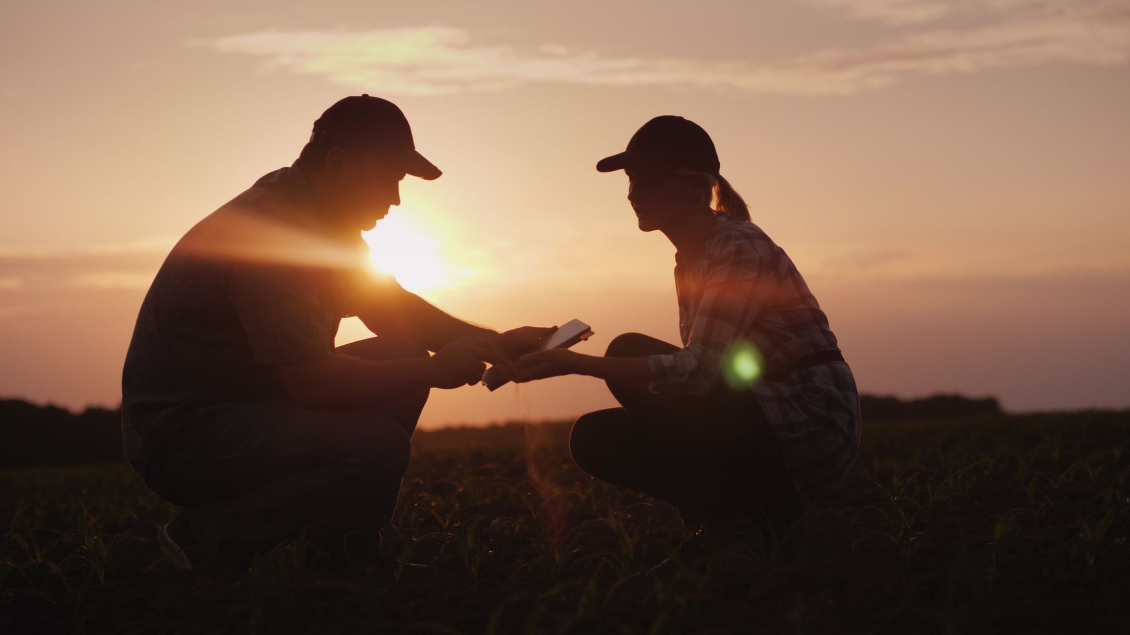
Crop insurance agents have long been positioned as the most “trusted advisor” with private grower data. The next step is for growers to trust their crop insurance agent with their Precision Ag data as well. Growers already trust agents with sensitive personal information and adding Precision Ag services to that existing relationship is a natural and economical fit that will benefit the grower, as well as the agent, both now and into the future.
Precision Ag – The Future of Farming and Reporting
Today many growers have precision ag technology in their equipment and on their farms. Growers that use Precision Ag equipment are finding they need help handling all of the data. They need a “trusted advisor” to help them decide how to use their data to improve their operation and impact their bottom line
With the ever-increasing federal compliance requirements throughout the reporting process, more and more data is needed. This can create a large burden for everyone – from the grower, to the agent, including reporting bodies such as crop insurance companies and governmental agencies.
Currently, reporting relies on manual paperwork which requires a great deal of processing time and effort. Once the documentation is gathered, there is still the task of keying or otherwise transmitting that data into a computerized system to transfer it between the necessary parties. There must be a better way, right?
Crop Insurance and Precision Ag Unite
The increasing integration of Precision Ag into the everyday lives of growers and agricultural businesses has provided a great opportunity to turn crop insurance reporting requirements into a quick and painless procedure.
The accuracy of a Precision Ag system, mainly planting and yield monitoring, can be far better than the previous generation’s methods of recording the same information. These systems automatically compile the what / where / why / when / how information and combine it with the necessary data for reporting purposes – all with minimal manual entry.
The days of manually going through each paper field record and writing and matching all the required information are numbered. Precision Ag systems can compile everything in one file which can simply be sent to the crop insurance agent who then matches the farmer’s data to USDA and crop insurance data.
The relationship between a grower and their crop insurance agent is the most trusted relationship in modern agriculture today. This is due to the personal information which a crop insurance agent currently handles in reporting to the government. Data integrity and security is of the utmost importance for this risk management program to succeed. Trust is everything and it will only increase in importance as growers begin to work with electronic data. Soon we will see a massive increase in the amount of Precision Ag data that will be available. ProAg believes that our crop insurance agents are and will continue to be the preferred trusted advisor to handle this data.
ProAg’s Position on Precision Ag / Digital Ag
Precision Ag or Digital Ag can mean a lot of things to a lot of different people. As one of the nation’s leading providers of crop insurance, ProAg is committed to helping our agents and their growers translate the data captured from the grower’s machinery and populate it into the required government forms.
ProAg is actively involved in exploring and developing the capabilities necessary to accomplish this task. Solutions must be easy and painless for our growers and ensure data integrity and security. ProAg is currently working on several data-driven solutions as digital ag technology continues to advance. You can find more information on what is available to you by downloading our digital ag reporting guide and checklist below.
We appreciate your trust in ProAg and look forward to sharing new solutions with you in the near future.
"*" indicates required fields